
Exploring for new oil reserves is one of the most crucial, challenging, and dynamic aspects of the global energy sector. It is a highly sophisticated process that combines scientific inquiry, technological innovation, and strategic decision-making. Modern oil exploration goes far beyond the historical days of drilling random wells and hoping for success—today, it is a meticulously planned and executed operation that demands multidisciplinary expertise.
The search for hydrocarbons begins long before the first drill bit ever touches the ground. It involves understanding the earth's geological history, utilizing advanced geophysical techniques to "see" beneath the surface, leveraging massive data sets through artificial intelligence, and performing comprehensive environmental and risk assessments to ensure operations are sustainable and socially responsible.
This detailed guide will take you through each vital stage of the exploration process. From initial geological assessments to cutting-edge AI-driven interpretations and rigorous environmental studies, you will discover how companies systematically locate new oil reserves, reduce uncertainties, and strive to minimize their environmental footprint. Let's delve into the fascinating journey of modern oil exploration, where science meets innovation to fuel our world.
Finding new oil reserves is a complex and high-stakes venture critical to sustaining the global economy and meeting energy demands. The process demands more than mere guesswork; it blends deep geological knowledge, cutting-edge geophysical technology, advanced data interpretation, and careful environmental planning. In today's competitive and environmentally conscious landscape, companies use a combination of traditional expertise and innovative tools to locate untapped reserves efficiently and responsibly.
In this expanded guide, we will dive deeper into the essential techniques used throughout the oil exploration journey, from initial surveys to confirmatory drilling and risk management.
Geological Surveys
Geological surveys are the cornerstone of the oil exploration process, serving as the first, vital step toward uncovering potential hydrocarbon-rich regions. These surveys involve a deep, systematic study of the Earth's surface features, subsurface geology, and historical patterns to build an initial understanding of where oil and gas might be located.
Detailed Exploration Methods:
- Surface Mapping: Geologists meticulously map the surface features, identifying key formations like anticlines, synclines, faults, and salt domes that are often associated with oil traps. Sedimentary rock layers are especially significant because they are the most common reservoirs for hydrocarbons.
- Satellite Imagery and Remote Sensing: High-resolution satellite imagery and remote sensing tools enable experts to detect subtle surface anomalies, lineaments, vegetation stress patterns, and structural trends that might indicate underlying oil-bearing structures.
- Field Studies and Rock Sampling: Geologists collect rock and soil samples directly from the field to study their mineral composition, porosity, and permeability. These physical properties are essential indicators of a rock’s potential to act as a reservoir or a cap rock.
- Geochemical Surveys: Soil, gas, and water samples are analyzed for the presence of hydrocarbons or pathfinder elements. Tiny traces of hydrocarbons leaking to the surface (microseepages) can signal a larger deposit underground.
- Historical Data Review: Exploration teams review existing geological maps, prior drilling records, well logs, and regional geological studies. Understanding what has been discovered (or not discovered) in the past refines the search strategy.
Why Geological Surveys Matter:
- Risk Reduction: By narrowing down exploration areas, geological surveys significantly lower the risk of investing in unproductive drilling.
- Cost Efficiency: Targeted exploration saves millions of dollars by focusing resources on the most promising zones.
- Strategic Planning: Early geological insights shape the entire exploration strategy, influencing everything from the selection of geophysical methods to the final placement of exploratory wells.
In essence, geological surveys set the stage for a successful exploration campaign. They provide the essential groundwork upon which more advanced geophysical techniques and exploratory drilling are based, making them a critical first step in the quest for new oil reserves.
In-Depth Techniques:
- Surface Mapping: Geologists closely examine surface rock formations, paying special attention to sedimentary basins, anticlines, faults, and folds that could act as traps for oil and gas.
- Satellite and Aerial Imagery: Using high-resolution satellite data and aerial reconnaissance, experts identify surface anomalies, lineaments, and changes in vegetation that may indicate underlying hydrocarbons.
- Geochemical Sampling: Collection and analysis of soil, water, and gas samples can detect hydrocarbon microseepages, offering direct evidence of potential oil presence.
- Historical Records and Regional Studies: Exploration teams review old drilling records, geological maps, and previous survey data to build an initial model of the area's hydrocarbon potential.
Why It Matters: By narrowing down vast regions into specific high-potential zones, geological surveys save enormous amounts of time, cost, and effort in the exploration process.
Geophysical Surveys
Once geological surveys identify promising surface indicators, the next critical step in exploration is conducting geophysical surveys. These sophisticated techniques provide a window into the Earth's subsurface, enabling companies to visualize underground formations and structures without breaking ground. Geophysical surveys refine the target area further and minimize the uncertainty and risks associated with drilling.
Detailed Exploration Methods:
- Seismic Reflection Surveys: Controlled energy sources, such as vibroseis trucks or small explosive charges, generate seismic waves that travel through the Earth. When these waves encounter different rock layers, they reflect back to the surface where arrays of geophones capture the returning signals. The data is then processed to create detailed images of subsurface structures, highlighting potential traps and reservoirs.
- Seismic Refraction Surveys: These surveys measure the bending (refraction) of seismic waves as they pass through various subsurface layers. By analyzing wave travel times and paths, geophysicists can differentiate rock types and locate fault zones or stratigraphic traps where oil and gas might accumulate.
- Gravity Surveys: Small differences in gravitational pull are measured to detect variations in underground rock densities. Oil-bearing formations, often lighter than surrounding rocks, create subtle gravity anomalies that can indicate the presence of hydrocarbon traps.
- Magnetic Surveys: Instruments onboard aircraft or ground vehicles detect anomalies in the Earth's magnetic field caused by variations in the magnetic properties of subsurface rocks. Magnetic surveys are particularly useful in identifying structural features like ancient rift basins and salt domes.
Integrated Surveying:
Modern exploration programs often integrate multiple geophysical methods to cross-validate findings and increase the accuracy of interpretations. For instance, seismic and gravity data can be layered together to provide a more comprehensive understanding of the subsurface.
Why Geophysical Surveys Matter:
- Enhanced Subsurface Visualization: Geophysical surveys produce three-dimensional models of underground formations, dramatically improving the ability to pinpoint potential hydrocarbon zones.
- Reduced Exploration Risk: By providing a non-invasive, cost-effective means of subsurface analysis, geophysical surveys help prioritize drilling locations and avoid costly dry wells.
- Efficient Resource Allocation: Accurate geophysical imaging ensures that exploration budgets are directed toward the most promising prospects, increasing the overall return on investment.
Geophysical surveys represent a major leap forward in exploration science, transforming educated guesses into evidence-based drilling targets and significantly increasing the odds of successful oil and gas discoveries.
In-Depth Techniques:
- Seismic Reflection Surveys: Utilizing controlled energy sources (like explosives or vibroseis trucks), sound waves are propagated into the ground. Reflections from different rock layers are recorded by geophones, creating images of subsurface structures.
- Seismic Refraction Surveys: Measures the time it takes for seismic waves to refract through various geological layers, helping differentiate rock types and detect faults.
- Gravity Surveys: Instruments measure tiny variations in Earth's gravitational field caused by differences in subsurface rock densities. Oil-bearing structures often have distinct gravity signatures.
- Magnetic Surveys: Detect subtle changes in Earth's magnetic field resulting from different mineral compositions, indirectly revealing structural traps or basins favorable for oil accumulation.
Why It Matters: Geophysical surveys dramatically increase the precision of exploration efforts by generating virtual cross-sections of the subsurface, minimizing guesswork before drilling.
Seismic Reflection and Refraction Techniques
Seismic reflection and refraction techniques are regarded as the cornerstone of modern oil exploration. These advanced methods allow geologists and geophysicists to visualize the subsurface in remarkable detail, enabling precise identification of structures that could potentially trap hydrocarbons.
Detailed Exploration Techniques:
- 2D Seismic Surveys: In a 2D seismic survey, seismic waves are generated and their reflections are recorded along a single line. These linear cross-sectional images provide a preliminary, cost-effective view of the subsurface layers, revealing the general geology and major structural features.
- 3D Seismic Surveys: Building upon 2D data, 3D surveys involve recording seismic reflections over a grid of lines. The data is processed to create a three-dimensional volumetric model of the subsurface, offering a much more detailed and accurate picture of potential reservoirs. 3D seismic greatly improves the ability to map complex structures such as faulted traps, stratigraphic traps, and subtle structural variations critical to successful exploration.
- 4D Seismic Surveys (Time-Lapse Seismic): 4D seismic involves conducting repeat 3D seismic surveys over the same field at different times. This method helps monitor dynamic changes in a reservoir, such as fluid movement, pressure variations, and depletion over time. 4D seismic is invaluable for optimizing recovery from existing fields and for planning secondary and tertiary recovery operations.
- Ocean Bottom Seismometers (OBS): In offshore environments, particularly deepwater regions, OBS technology places seismometers directly on the seafloor to record seismic data. This technique improves data quality dramatically compared to traditional surface towed arrays, allowing for clearer imaging beneath complex seabed structures and salt formations.
Data Processing and Interpretation:
After acquisition, seismic data undergoes extensive processing to remove noise, enhance signal quality, and create accurate images. Advanced software and high-powered computing are used to interpret seismic sections, identify potential hydrocarbon-bearing structures, and determine the best drilling locations.
Why Seismic Techniques Matter:
- Risk Reduction: High-resolution seismic images significantly reduce the uncertainty associated with drilling by allowing better prediction of subsurface conditions.
- Economic Efficiency: Fewer dry wells mean substantial cost savings and improved overall project profitability.
- Environmental Stewardship: Accurate subsurface models minimize unnecessary drilling, reducing the environmental footprint of exploration activities.
Seismic reflection and refraction surveys have revolutionized oil exploration by making it a data-driven science rather than a game of chance. These techniques form the backbone of every major exploration project today, underpinning decisions with precision and confidence.
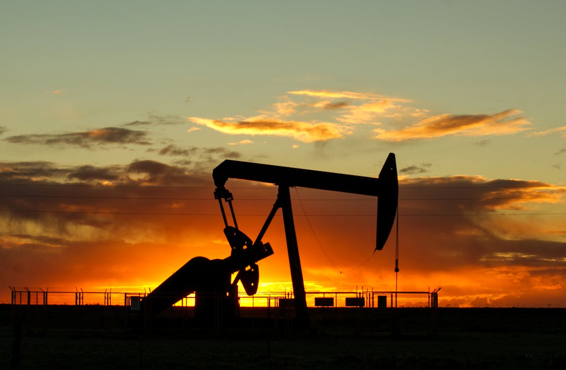
Exploratory Drilling
Exploratory drilling represents a pivotal phase in the oil exploration process—it is the moment where predictions are tested against reality. Despite all prior geological and geophysical assessments, the presence of hydrocarbons can only be confirmed by drilling into the earth and examining what lies beneath.
Detailed Techniques and Procedures:
- Wildcat Wells: Wildcat wells are the first wells drilled in an unexplored area. They are considered high-risk, high-reward endeavors. Drilled based on promising seismic and geological data, these wells aim to confirm the presence of commercially viable oil and gas accumulations.
- Coring: During drilling operations, cylindrical sections of subsurface rock—known as cores—are extracted and preserved. Core samples provide a tangible record of the underground formations, allowing geologists to analyze rock porosity, permeability, lithology, and fluid content in a laboratory setting. Coring is crucial for understanding reservoir quality.
- Well Logging: After drilling reaches targeted formations, various instruments are lowered into the wellbore to measure physical properties of the surrounding rocks and fluids. Techniques include:
- Resistivity Logging: Measures the resistance of rock formations to electrical current, helping differentiate between oil, gas, and water-bearing layers.
- Porosity Logging: Estimates how much pore space exists within the rocks, indicating potential hydrocarbon storage capacity.
- Sonic Logging: Uses sound waves to measure formation elasticity, aiding in lithology identification.
- Gamma Ray Logging: Measures natural radioactivity to distinguish shale from cleaner reservoir rocks.
- Drill Stem Testing (DST): In this technique, specialized tools temporarily isolate sections of the well, allowing engineers to test the formation's pressure, fluid content, and permeability directly. DST results help determine whether the reservoir can produce hydrocarbons at a commercially sustainable rate.
Importance of Exploratory Drilling:
- Validation of Data: Exploratory drilling provides the only direct method to confirm or disprove subsurface predictions made during earlier survey stages.
- Reservoir Characterization: Detailed data collected during drilling help define the size, pressure, fluid composition, and overall commercial viability of the discovered reservoir.
- Investment Decisions: Information gathered from exploratory wells guides critical financial and operational decisions regarding full-field development, infrastructure investments, and production planning.
Despite technological advancements in remote sensing and modeling, exploratory drilling remains a necessary, tangible step in the discovery process—bridging the gap between theoretical potential and actual resource realization.
Advanced Data Interpretation and Artificial Intelligence (AI)
The era of digital transformation has revolutionized oil exploration, with advanced data interpretation and artificial intelligence (AI) playing increasingly critical roles. With seismic surveys, well logs, core samples, and production data generating massive volumes of information, traditional manual interpretation methods are no longer sufficient. Companies now harness powerful AI-driven tools to sift through complex datasets, extract meaningful patterns, and make faster, smarter exploration decisions.
In-Depth Techniques and Tools:
- Machine Learning Algorithms: Machine learning models are trained on historical seismic, geological, and drilling data to detect hidden patterns and predict the likelihood of hydrocarbon presence. They can identify subtle anomalies in seismic images or infer the properties of unseen rock layers with far greater speed and accuracy than human interpreters.
- Neural Networks for Seismic Interpretation: Deep learning techniques, particularly convolutional neural networks (CNNs), are increasingly used to automate seismic interpretation, rapidly detecting features like faults, salt domes, stratigraphic traps, and reservoirs that were previously time-consuming to map manually.
- Predictive Reservoir Modeling: Advanced simulations create detailed 3D models of subsurface reservoirs. By integrating petrophysical data, production history, and fluid properties, AI can predict how a reservoir might behave during production, aiding in well placement and enhanced oil recovery strategies.
- Data Fusion and Integration: Modern exploration platforms merge diverse datasets—seismic imaging, well logs, satellite data, and even real-time drilling data—into unified, interactive models. This holistic view improves the accuracy of prospect evaluation and reduces uncertainty.
- Natural Language Processing (NLP): AI-driven NLP systems are being used to analyze technical reports, geological papers, and drilling records, extracting valuable insights from textual data that would be tedious for geoscientists to comb through manually.
Benefits of AI in Oil Exploration:
- Accelerated Decision-Making: AI tools drastically reduce the time required to interpret seismic and geological data, allowing faster prospect identification and reducing exploration cycle times.
- Improved Accuracy: By detecting patterns often missed by the human eye, AI enhances the precision of reservoir characterization and reduces the chances of drilling dry wells.
- Cost Reduction: Faster, more reliable analysis minimizes wasted expenditures on unsuccessful wells and unnecessary surveys.
- Risk Mitigation: AI-driven predictions help companies assess geological risks earlier in the exploration process, improving resource allocation and operational safety.
Environmental and Risk Assessments
In today’s exploration landscape, environmental and risk assessments are no longer supplementary activities—they are integral to every project. Companies recognize that protecting ecosystems, respecting communities, and maintaining regulatory compliance are crucial for securing project approvals, sustaining operations, and preserving corporate reputation.
Comprehensive Techniques and Processes:
- Baseline Environmental Surveys: Before any exploration activity begins, companies conduct detailed surveys to document the existing condition of the environment, including air quality, water quality, soil composition, flora, fauna, and local biodiversity. These baseline measurements serve as critical reference points for assessing future changes and impacts.
- Ecological and Social Impact Studies: Specialized studies assess how exploration activities might affect sensitive ecosystems, endangered species, and local communities. This includes analyzing potential disruptions to wildlife habitats, migration patterns, and traditional land uses by indigenous populations.
- Risk Identification and Analysis: Companies perform systematic risk assessments to identify potential hazards such as oil spills, groundwater contamination, air pollution, and seismic disturbances. Each identified risk is evaluated based on its likelihood and potential severity.
- Mitigation Planning: Once risks are identified, detailed mitigation plans are crafted. Strategies may include spill prevention systems, erosion control measures, habitat restoration initiatives, and emergency response protocols to manage and reduce environmental and operational risks.
- Stakeholder and Community Engagement: Building strong relationships with local communities is paramount. Companies engage in dialogue with stakeholders to understand their concerns, incorporate their feedback into project planning, and foster transparency. Programs might include job creation, community development projects, and environmental education initiatives.
- Regulatory Compliance and Reporting: Adherence to national and international environmental standards (such as ISO 14001, IFC Performance Standards, and local laws) is mandatory. Continuous environmental monitoring and periodic reporting ensure that exploration activities remain within regulatory boundaries and that corrective actions are implemented promptly when needed.
Why Environmental and Risk Assessments Matter:
- Regulatory Approvals: Robust environmental assessments are often mandatory for securing exploration licenses and permits.
- Social License to Operate: Gaining and maintaining community support reduces the likelihood of protests, legal challenges, or operational delays.
- Operational Efficiency: Identifying risks early helps prevent costly incidents and minimizes downtime.
- Corporate Sustainability Goals: Environmental stewardship is critical for achieving broader corporate sustainability objectives and demonstrating responsibility to investors and the public.
Modern oil exploration acknowledges that economic success must go hand-in-hand with environmental and social responsibility. Comprehensive environmental and risk assessments ensure that exploration projects contribute positively to local communities, protect fragile ecosystems, and align with the growing global commitment to sustainable development.
Conclusion
Oil exploration today is no longer a mere game of chance but a sophisticated blend of science, technology, and responsible stewardship. Each stage—from geological surveys and seismic imaging to AI-driven data interpretation and comprehensive environmental assessments—works synergistically to increase discovery success rates while minimizing environmental and financial risks.
Modern exploration requires a multidisciplinary approach where geoscientists, engineers, environmental specialists, and data scientists collaborate seamlessly. The application of cutting-edge technologies such as 3D and 4D seismic surveys, machine learning algorithms, and predictive reservoir modeling has transformed exploration into a data-driven endeavor, significantly reducing the number of dry wells and optimizing resource allocation.
Furthermore, with growing societal and regulatory expectations, companies must now prioritize sustainability as much as profitability. Comprehensive environmental impact assessments, community engagement, and rigorous risk mitigation strategies ensure that exploration activities align with global efforts toward sustainable development and corporate responsibility.
As technology continues to advance and the energy landscape evolves, the future of oil exploration lies in smarter, cleaner, and more efficient practices. Companies that embrace innovation, data integration, and environmental consciousness will not only discover new reserves but also lead the way toward a more responsible and resilient energy future.
Oil exploration stands at the crossroads of tradition and transformation—and those willing to innovate boldly will shape the next chapter of fueling the world. today is an intricate dance between earth science, engineering innovation, environmental stewardship, and big data mastery. From geological surveys and seismic imaging to AI-driven interpretations and rigorous environmental assessments, each stage builds on the previous to minimize risk and maximize the probability of discovery.
As technological advancements continue, exploration will become even more precise, efficient, and sustainable—helping the world meet its growing energy needs while respecting our fragile planet.
Stay tuned as the frontier of oil exploration continues to be shaped by relentless innovation, collaboration, and a commitment to a smarter energy future!


